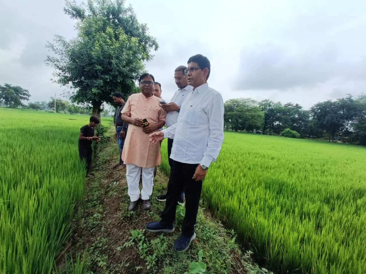
Revenue Minister Tankaram Verma today observed the digital crop survey in village Sakri of Balodabazar Bhatapara district. He walked through the footpaths to the middle of the field and verified the Khasra by entering it through geo-referencing through mobile. For this, Minister Verma himself became the surveyor. He completed the verification work of Khasra number 1150, 1151 and 1152 of the field of farmer Netram Sahu of village Sakri. Verma said that Prime Minister Narendra Modi has set the goal of developing India as a developed India by 2047, under which the government is using digital technology in all government works, digital crop survey is also an example of it. This provides accurate information about the crop. balodabazar
Along with this, the name of the crop commodity sown in the field, estimated area of all crops in case of mixed crop, information about irrigated-non-irrigated crop, one-year or multi-year, seasonal crop etc. will be filled. The surveyor will enter the estimated area of the sown crop or fallow land in the software in case of single or mixed crop and the commodity sown. If the total of the surveyed area does not match the geo-referenced area in the software, the data will not be saved until then. The surveyor will not capture the photo by standing on the ridge of any Khasra number land. If they do so, there will be a longitude-latitude mismatch of the surrounding Khasra number. Therefore, the surveyor will conduct the experiment by going at least 10 meters from the ridge inside the land of each Khasra number. If wheat crop is visible in the picture but the surveyor has entered paddy or the plot is empty and the photo of sugarcane has been uploaded, then the Patwari will resend the same data. The surveyor will correct it and send it to the Patwari again. If the Patwari rejects it again, then it will come in the ID of RI. This is currently different from the Girdawari done by the Patwari in the traditional way. Paddy purchase will be done on the basis of Girdawari done by Patwari. Digital crop survey will be done in those villages only where the second level work of georeferencing has been completed. It will not be done in the Khasra numbers of all the villages. This is a multi-dimensional scheme of the government. This work has to be done in a positive manner. The software has been made very easy. It can be used in any version of Android mobile which supports it. On this occasion, Vice President State Scout and Guide Vijay Kesarwani, SDM Balodabazar Amit Gupta, Tehsildar Raju Patel were present.
It is worth noting that in digital crop survey, the role of private surveyor is in the form of geo-reference, who will survey the crop digitally by going to all the fields. Private surveyor has been given the task of 30 to 50 Khasras daily. For which the surveyor will go to the field and login. Tehsildar will ask them whether you are available and the answer will be yes. Similarly, the status of the plot, Khasra number and name of the area owner will be automatically fed in the app. Three photographs of the crop grown have to be uploaded along with its longitude and latitude. In this way the work of one number will be completed. In which the role of the Patwari has been assigned the role of supervisor and the role of the Revenue Inspector as verifier and the role of the Tehsildar and Naib Tehsildar as investigating officers. All Khasras edited by the surveyors will not go to the RI. The Khasras surveyed by the surveyors will go to the Patwari. The Patwari will approve or resend it. In the event of it being rejected twice by the Patwari, it will come to the RI’s ID. The number of such Khasras will be very less, where verification will be done as per requirement by going to the spot.