Sikkim: The weather patterns are constantly changing in many areas of the country. Western disturbance is active over Haryana and surrounding areas. At the same time, the south-west monsoon is also progressing slowly. Due to its effect, there is a possibility of thunderstorms, strong winds and rain in many states.
According to the forecast released by the Meteorological Department today, on the morning of June 27, 2026, the people of Delhi-NCR will get some relief from the scorching heat and humidity, but will have to wait for a few more days for the arrival of monsoon. Now monsoon is expected to reach Delhi in the first week of July.
Warning of storm and lightning in many states of North India
The Meteorological Department has predicted strong winds at a speed of 40 to 50 kilometers per hour along with thunderstorms in Haryana, Punjab, Delhi, Uttarakhand, Eastern Uttar Pradesh and Western Rajasthan today, June 27, 2026. In East Rajasthan also, strong winds can blow at a speed of 30 to 40 kilometers per hour.
In some areas of Jharkhand, the wind speed can reach 50 to 60 kilometers per hour during severe thunderstorms. In such weather, people have been advised to avoid going to open places and stay in a safe place.
Temperature will be around 40 degrees in Delhi-NCR
The maximum temperature in Delhi-NCR today is expected to be around 40 degrees Celsius and the minimum temperature is expected to be 26 degrees Celsius. It may remain humid during the day, but in the evening the weather may become pleasant due to strong winds and light rain at some places. However, we will have to wait for a few more days for the formal entry of monsoon.
Alert of heavy to severe rain in many areas of the country
Due to monsoon, the rainy season is likely to continue in Northeast India. Heavy to very heavy rainfall may occur in many areas of Assam and Meghalaya, Arunachal Pradesh, Nagaland, Manipur, Mizoram and Tripura. These states may receive rainfall ranging from 115.6 to 204.4 mm. Orange alert has been issued for heavy rain here.
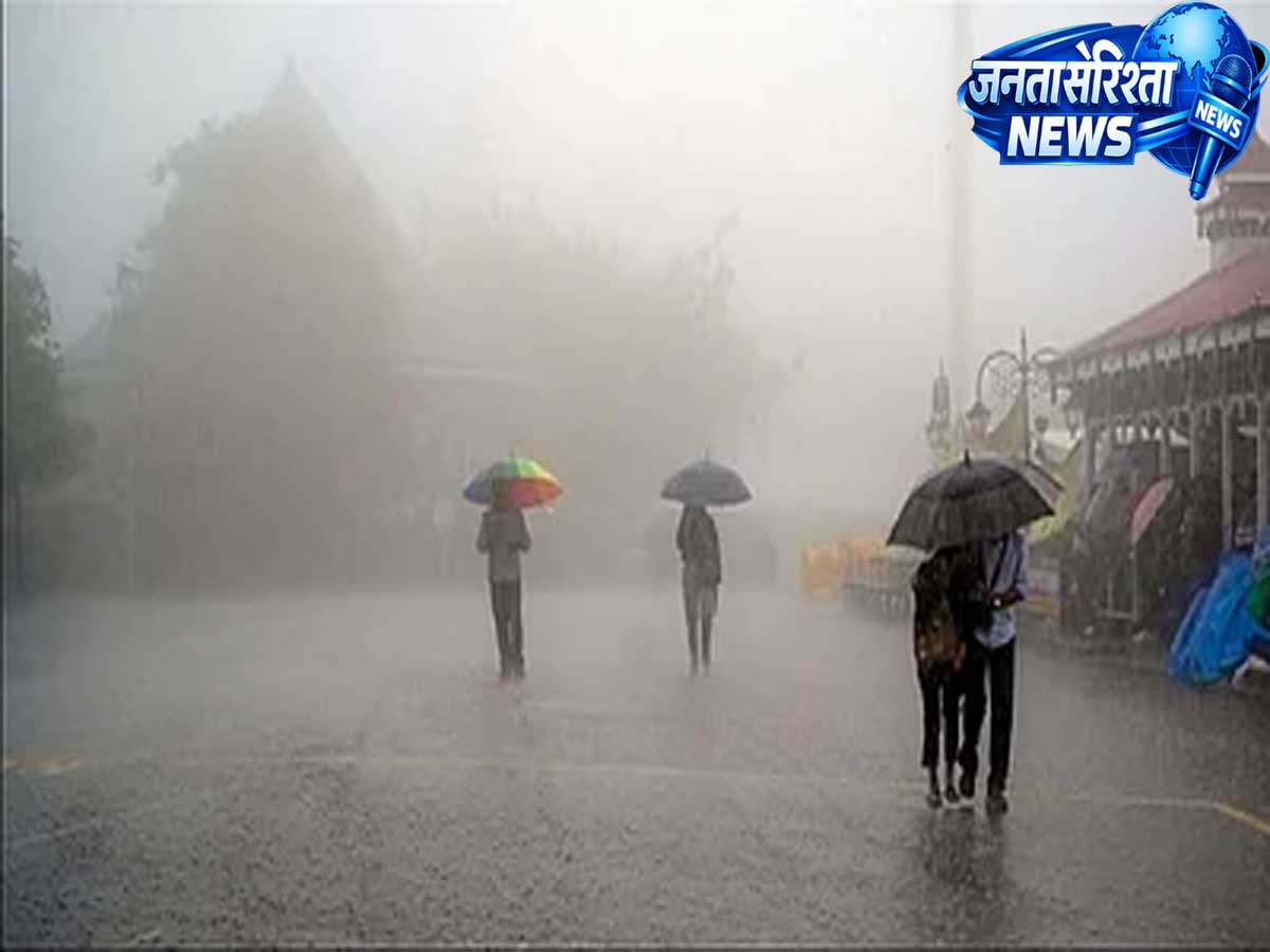
Today, a warning has been issued of very heavy to very heavy rainfall in some parts of Sub-Himalayan West Bengal and Sikkim. Here the department has issued a red alert for rain. More than 204.5 mm of clouds may rain in these states.
Apart from this, heavy rains are also expected in Bihar, Odisha, Chhattisgarh, Coastal Andhra Pradesh, Konkan-Goa, Kerala, Coastal Karnataka, Tamil Nadu, Telangana and North Interior Karnataka today. There are chances of rainfall ranging from 64.5 to 115.5 mm in all these states. Yellow alert is issued for rain here. The Meteorological Department has said that due to heavy rains, waterlogging in low-lying areas and flood-like situation may occur at some places.
Monsoon continues to advance
According to the Meteorological Department, the south-west monsoon is gradually moving towards north and west India. Conditions remain favorable for advance of Monsoon into some parts of Gujarat, Madhya Pradesh, remaining parts of Chhattisgarh, Jharkhand, Bihar, Uttar Pradesh and Uttarakhand during the next three to four days. Due to this, rain activities may increase in these areas and people are expected to get relief from the heat.
temperature fluctuations
The forecast issued by the Meteorological Department states that there is a possibility of a gradual increase of two to four degrees Celsius in the maximum temperature in Maharashtra by June 29. After this, no major change in temperature is expected.
In most areas of Central India, the temperature may increase by two to three degrees Celsius between June 27 and 29. However, after this the temperature is likely to drop again by two to three degrees Celsius.
In most other parts of the country, there is no possibility of any major change in the maximum temperature till July 2, 2026.
Yesterday, on June 26, 2026, the highest maximum temperature of 43.4 degrees Celsius was recorded in Rohtak, Haryana in the plains of the country. Whereas in Jeur, Maharashtra, the lowest minimum temperature was recorded at 18.5 degrees Celsius.
Heatwave continues to affect eastern Uttar Pradesh
Despite rain and storm activity, there is no respite from heatwave in eastern Uttar Pradesh. There are chances of severe heat wave conditions persisting in some parts. Heat wave may also occur in some areas of western Uttar Pradesh. At the same time, hot and humid weather in some parts of Odisha can increase the problems of the people. In such weather, it has been advised to drink enough water, avoid sunlight in the afternoon and go out of the house only when necessary.
Strong winds in the sea, warning for fishermen
Today, strong winds are expected in many parts of the Arabian Sea and Bay of Bengal. Wind speed in the Arabian Sea can reach 45 to 55 kilometers per hour to 65 kilometers per hour. Bad weather is also expected in the maritime areas of Konkan, Goa, Karnataka, Kerala and Lakshadweep. Similarly, warning of strong winds has also been issued in some parts of the Bay of Bengal. The Meteorological Department has advised fishermen not to go into the sea at present.
People and farmers should be careful
The Meteorological Department has appealed to the people and farmers to stay in safe places during bad weather and keep an eye on the latest weather updates. Stay away from open fields, trees and electric poles during thunderstorms. Avoid unnecessary travel in areas with heavy rainfall. Traffic may also be affected due to strong winds and rain. With the further advance of monsoon in the coming days, a major change in the weather may be seen in many parts of the country.
Red alert of heavy rain in West Bengal-Sikkim, danger increased in many areas